Parcel 00845120006 is one of the most frequently searched parcels in Collier County, with hundreds of monthly impressions from users looking for ownership records, sales history, tax assessments, land value, and legal property details. This 2.5-acre tract is located in Naples (ZIP 34117) and is classified as acreage, making it highly relevant for investors, buyers, researchers, and land-use analysts.
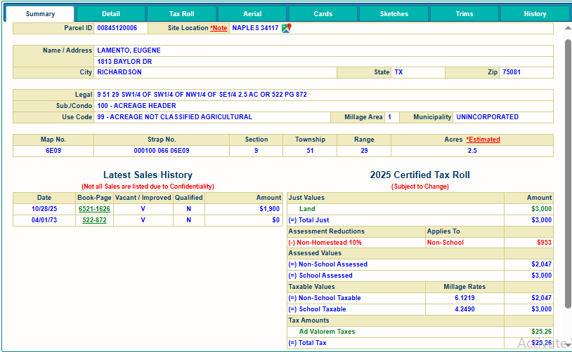
Table of Contents
1. Owner & Parcel Identification Details
Parcel 00845120006 is registered under the owner Eugene Lamento, with a Texas mailing address. The parcel itself is located in a rural, unincorporated area of the county.
Property & Ownership Summary
| Field | Details |
|---|---|
| Parcel ID | 00845120006 |
| Owner Name | LAMENTO, EUGENE |
| Mailing Address | 1813 BAYLOR DR, RICHARDSON, TX 75081 |
| Property City | Naples, Florida 34117 |
| Municipality | Unincorporated |
| Use Code | 99 – Acreage Not Classified Agricultural |
| Subdivision | 100 – Acreage Header |
| Estimated Area | 2.5 Acres |
This parcel is not tied to a platted residential subdivision; instead, it is categorized under an acreage header commonly used for rural, undeveloped, or multi-purpose land. Due to its non-agricultural classification, the property is assessed at standard non-homestead rates.
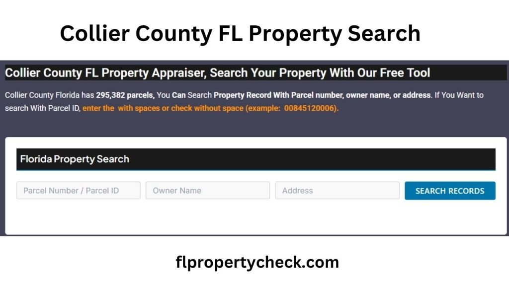
You can easily search more parcels in Collier County, Florida using our free online property search tool. Find detailed information including ownership records, sales history, assessed values, tax data, legal descriptions, and parcel locations. Quickly access accurate property records for research, investment, or buying decisions, all at no cost.
2. Site Characteristics & Geographic Information
This 2.5-acre parcel lies within a low-density area of the county, commonly sought by buyers who want large parcels for future development, agricultural potential, or private residential builds. Although the parcel is officially vacant, its location provides access to nearby primary roads and essential services.
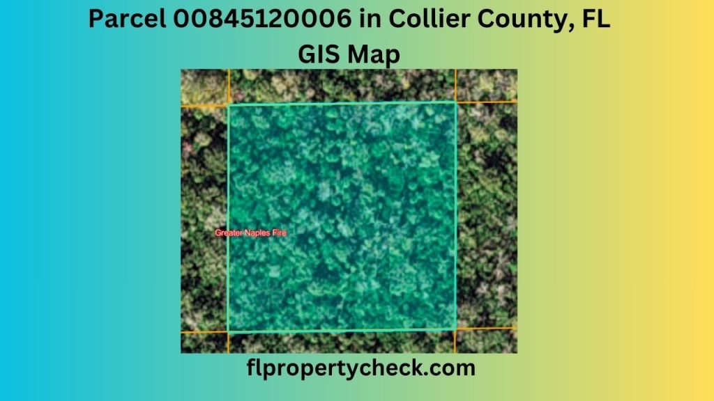
Legal & Geographic Description
| Field | Details |
|---|---|
| Legal Description | 9 51 29 SW1/4 OF SW1/4 OF NW1/4 OF SE1/4 – 2.5 AC (OR 522 PG 872) |
| Section | 9 |
| Township | 51 |
| Range | 29 |
| Map No. | 6E09 |
| Strap No. | 000100 066 06E09 |
The legal description indicates the parcel lies within a fractional section, a common layout for larger or rural acreage. This classification also aligns with the use code indicating no agricultural classification.
3. Latest Sales History of Parcel 00845120006
Users frequently search for the sales history of this parcel, and the county record shows only two publicly available transactions. These sales highlight long-term ownership and low valuation typical of rural, undeveloped acreage.

Sales History
| Date | Book–Page | Vacant / Improved | Qualified | Sale Amount |
|---|---|---|---|---|
| 10/28/2025 | 6521-1626 | Vacant | No | $1,900 |
| 04/01/1973 | 522-872 | Vacant | No | $0 |
The most recent 2025 sale was a low-value transaction consistent with raw land pricing. Because both transactions are marked Not Qualified, they are not used as valid comparables for assessment purposes.
4. 2025 Certified Tax Roll – Values, Assessments & Millage Rates
The 2025 tax roll provides the most current available assessment values. Although subject to change, these values help determine tax responsibility and reflect the county’s evaluation of the parcel.
Just & Assessed Values
| Category | Amount |
|---|---|
| Land Just Value | $3,000 |
| Total Just Value | $3,000 |
| Non-School Assessed Value | $2,047 |
| School Assessed Value | $3,000 |
Because this is a non-homestead property, it is subject to the 10% Non-School assessment limitation.
Assessment Reductions
| Reduction Type | Applied To | Amount |
|---|---|---|
| Non-Homestead 10% Cap | Non-School Value | $953 |
Taxable Values & Millage Rates
| Category | Millage Rate | Taxable Value |
|---|---|---|
| Non-School Taxable Value | 6.1219 | $2,047 |
| School Taxable Value | 4.2490 | $3,000 |
Total Tax Amount
| Tax Type | Amount |
|---|---|
| Ad Valorem Taxes | $25.26 |
| Total 2025 Tax | $25.26 |
This low annual tax amount reflects the parcel’s vacant land status and low assessed value.
5. Parcel Analysis & Investment Perspective
Parcel 00845120006 offers potential opportunities for investors seeking rural or low-cost acreage in Southwest Florida. Key considerations include:
Benefits
- Low holding cost due to minimal annual tax liability.
- Located in a growing region, with increasing interest in land development.
- Simple ownership history with long-term stability.
- Clear acreage and straightforward legal description simplify title verification.
Points to Consider
- The land is currently classified non-agricultural with no improvements.
- Buyers should verify zoning restrictions and possible land-use limitations.
- Development may require permitting, environmental review, or access road improvements.
Overall, this parcel remains a low-risk, low-cost land option with potential long-term value, especially as surrounding communities continue to expand.
Conclusion
Parcel 00845120006 is a rural 2.5-acre parcel in Collier County, Florida, widely searched for its straightforward ownership, low assessed value, and complete public record availability. With a stable history and minimal taxes, it serves as a practical option for long-term investment, land banking, or future development planning. By reviewing the detailed sales history, tax data, legal description, and property characteristics presented in this report, users gain a clear, reliable understanding of the parcel’s current status and potential opportunities.
6. Frequently Asked Questions (FAQs)
1. What is Parcel 00845120006 in Collier County?
Parcel 00845120006 is a 2.5-acre vacant land parcel in unincorporated Naples, Florida. It is classified under acreage and holds a current just value of $3,000 according to the 2025 tax roll.
2. Who owns Parcel 00845120006?
The registered owner is LAMENTO, EUGENE, with a mailing address in Richardson, Texas.
3. What is the latest sales history for this parcel?
The most recent recorded sale occurred on October 28, 2025 for $1,900, recorded as a non-qualified sale. An earlier sale from 1973 is also listed at $0.
4. How much are the property taxes for Parcel 00845120006?
For the 2025 tax year, the total property taxes are $25.26, based on assessed values and county millage rates.
5. Is the parcel located inside city limits?
No, the parcel lies in unincorporated Collier County, meaning services and zoning fall under county jurisdiction rather than municipal authority.
6. What is the zoning or land classification of the parcel?
The parcel is coded as Use Code 99 – Acreage Not Classified Agricultural. This normally represents undeveloped or mixed-use acreage not designated as agricultural.
7. How big is Parcel 00845120006?
The parcel covers approximately 2.5 acres, according to official county mapping records.
8. What can the land be used for?
Land-use eligibility depends on zoning rules, environmental factors, and county regulations. Buyers should verify exact permitted uses before development.